Construction and proposal of a new coastal spatial model for living with water in the Osaka Bay area in the era of climate change
- Flood control and waterfront access are unknowingly compatible.
A bird's-eye view of the Osaka Bay area shows razor-wire levees towering over the water's edge, seemingly cutting off people's connection to the sea and estuarine waters. This is the result of flood control measures to protect people's lives and livelihoods from storm surges and floods. However, people may be afraid of the outside world beyond the wall, secure in the protection of the high wall, and fearful that the wall may be breached one day, as well as a desire to be free from the sense of entrapment and to visit the outside world.
The trend to reconcile these conflicting characteristics of flood control and waterfront access has become a mainstream trend in coastal spatial restructuring around the world. One of the leading examples is the Climate Ready Boston project in Boston, U.S.A. In the summer of 2019, a field survey and interviews were conducted to understand the actual situation of coastal space realignment that balances flood control and waterfront accessibility. The idea is to build seawalls and embankments along the coast that are higher than the expected water level, and to spatialize the seawalls and embankments as parks and greenways. In addition, the project aims to create a transition zone between the water and land areas by constructing a "sponge" at the water's edge with tidal flats, reed beds, sandy beaches, rocky reefs, and living seawalls. However, at the time of the field survey in 2019, these plans had hardly been implemented.
Summer 2019 field survey
- Immediately after the field survey in Boston, a survey of the Osaka Bay area was conducted. Initially, the focus was only on the low waterfront accessibility of the area.
However, careful observation has revealed the following, which may actually be ahead of Climate Ready Boston. For example, a pathway stairway attached to an embankment, reeds taking root in an abandoned boat landing, a shrubby forest encroaching behind an embankment, a grassy area with perforated blocks, a stone revetment, and an artificial tidal flat.
In other words, the image of coastal spatial restructuring that combines flood control and access to shore, as depicted in Climate Ready Boston, has not yet been realized in the original city of Boston, while it is occurring spontaneously, albeit locally, along the Osaka Bay coast. However, only a few things have been identified. The whole picture is still unknown.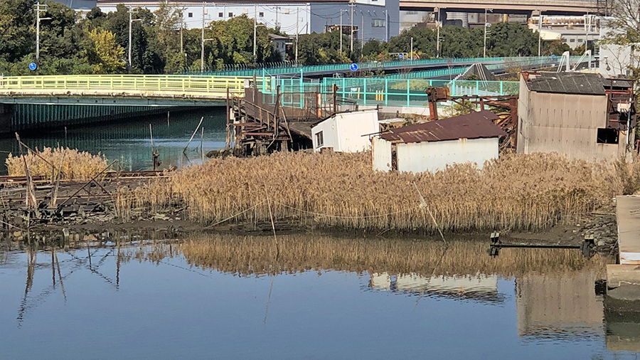
reeds taking root in an abandoned boat landing
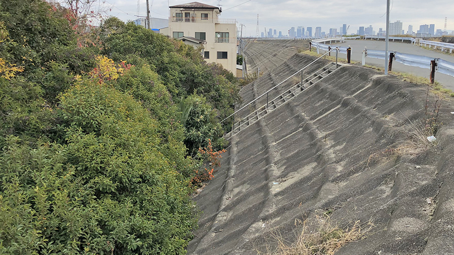
shrubby forest encroaching behind an embankment
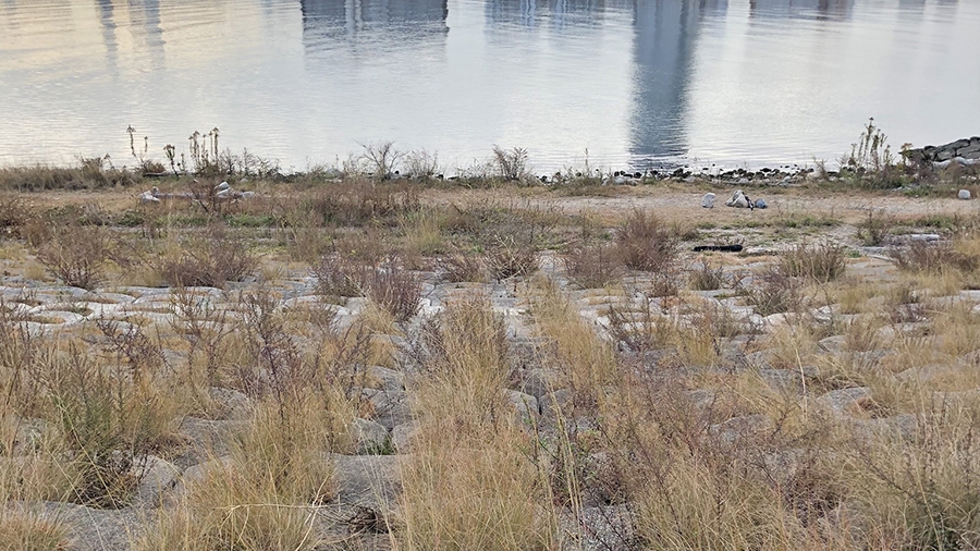
grassy area with perforated blocks

stone revetment
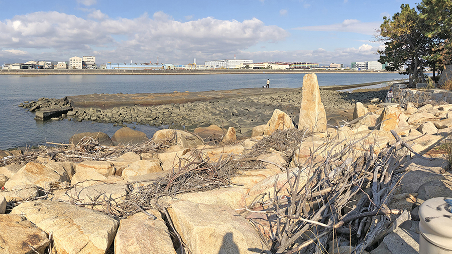
stone revetment
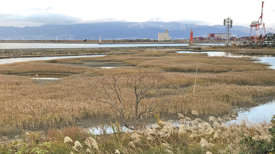
artificial tidal flat
Therefore, with the aim and focus of "discovering the unknown compatibility between flood control and waterfront access," researches on the accessibility and visibility of waterfront areas were conducted in five coastal wards of Osaka City where storm surge countermeasures were implemented.
Nishiyodo Waterfront Project Site
Murakami, S.(2024) How Cities Worldwide Are Addressing Rising Sea Levels: An Investigation Through the Resilient Cities Network's Published Documents, Reports of the City Planning Institute of Japan, No.23-2:115-121
Murakami, S.(2023) Understanding Urban Waterfront Behaviors through Social Media: An Investigation of Instagram Posts along the Coastal Areas of Osaka City, Reports of the City Planning Institute of Japan, No.22-2:117-121
Murakami, S.(2022) How should coastal spaces be like for living with water in the era of climate change? Identification of the cross-sectional shape of the coast in five wards of Osaka City facing Osaka Bay, Reports of the City Planning Institute of Japan, No.21-2:230-234
Murakami, S.(2021) Adapting to Sea-level Rise While Maintaining Water Accessibility: A Comparative Analysis between Boston and Osaka:57th IFLA2020 World Congress & World Landscape Architects Summit(18-22 August 2021, Live streaming from George Town, Penang, Malaysia)
Murakami, S.(2020) How will be the coastal urban spaces transformed by climate change adaption? A report on the areas where Climate Ready Boston initiatives will be implemented, Reports of the City Planning Institute of Japan, No.19:151-157
This research is supported by JSPS Grant-in-Aid for Scientific Research JP21K05656.


